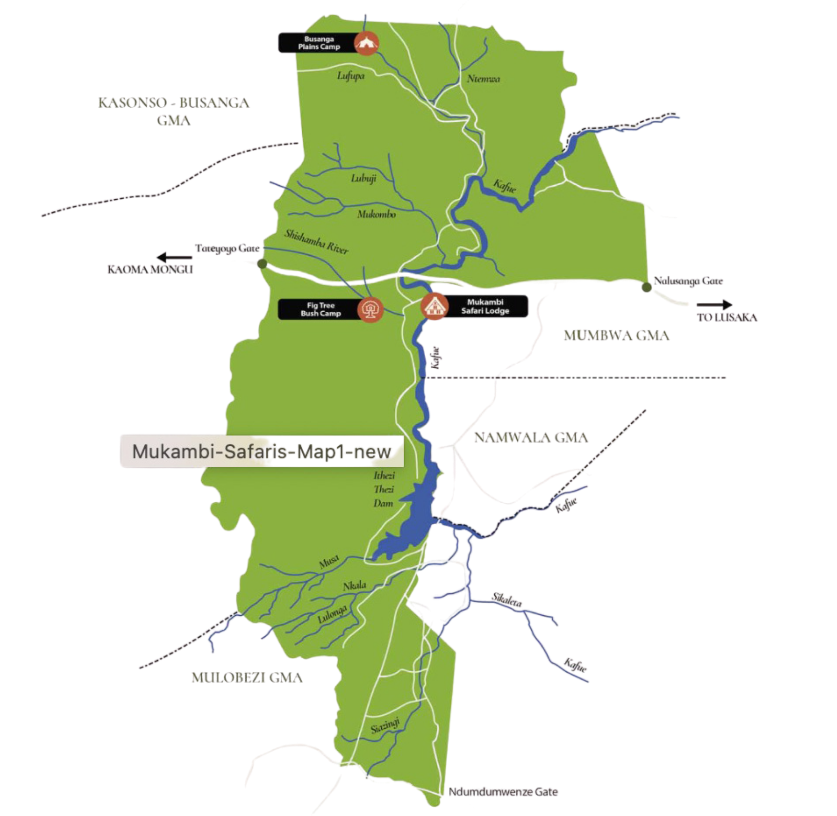
Kafue National Park spans roughly 22,400 km² and is defined by a mosaic of distinct ecological systems rather than a single dominant landscape. Each region operates differently in terms of water movement, vegetation structure and wildlife distribution.
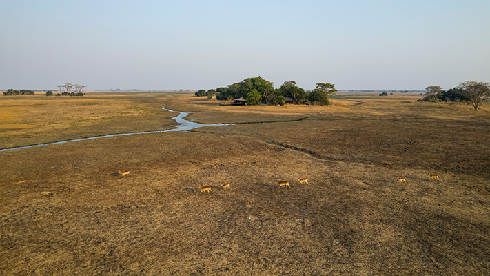
Northern Floodplains – The Busanga System
The northern sector is shaped by the seasonal wetlands of the Busanga Plains. Fed by the Lufupa River and rainfall, the plains flood extensively during the wet season. As waters recede, nutrient-rich grasses regenerate rapidly, supporting large populations of red lechwe, puku and buffalo.
The open terrain favours predators that rely on visibility and speed. Lion prides dominate territories across the plains. Cheetah are regularly seen due to ideal hunting conditions. Wild dog packs patrol woodland edges. Birdlife concentrates seasonally, particularly cranes and raptors.
Busanga is a pulse-driven ecosystem: productivity peaks after flood recession, compressing prey density into the dry season.
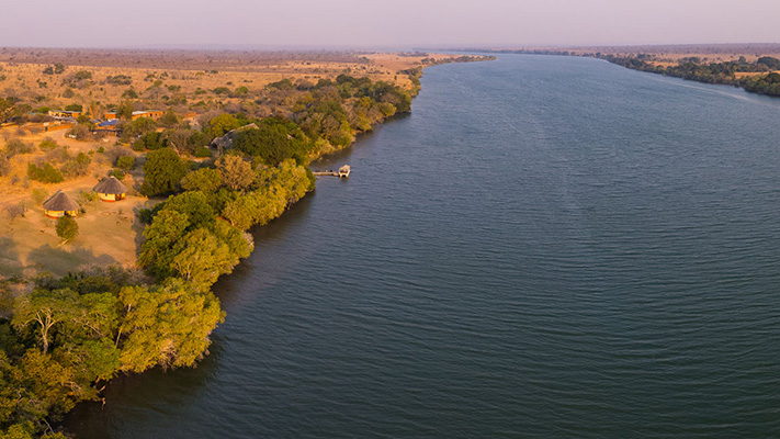
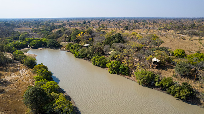
The Central River Corridor – The Kafue River System
The Kafue River forms the ecological spine of the park. Its permanent water creates riverine forests, floodplains and oxbow lagoons that stabilize wildlife presence year-round.
Hippo, crocodile and elephant rely on this corridor. Antelope densities increase during dry months as animals converge on reliable water. The river moderates local climate and sustains habitat continuity across otherwise dry woodland zones.
Central Miombo Woodland Belt
Miombo woodland dominates much of Kafue’s central region, composed primarily of Brachystegia and Julbernardia species. This system appears uniform but varies significantly with soil depth, drainage and fire regimes.
Sable and roan antelope prefer well-drained sections. Leopard use drainage lines and woodland edges. Elephants migrate seasonally between browse-rich woodland and floodplain grazing. The woodland matrix stabilizes hydrology and buffers floodplain systems.
This biome is structurally essential: it links all other ecosystems within the park.
Southern Grasslands, Dambos and the Itezhi-Tezhi System
In the south, open plains and seasonal dambos dominate. These shallow depressions retain moisture longer than surrounding areas, creating grazing gradients that attract zebra, eland and smaller antelope.
The southern boundary is defined by the Itezhi-Tezhi Dam, created by damming the Kafue River. The reservoir has introduced a large, permanent water body into the ecosystem. This has altered hydrological flow patterns downstream, influencing flood timing and volume on the Busanga Plains.
Ecologically, the dam area supports aquatic birdlife, crocodile and fisheries while creating new shoreline habitats. It also forms a transitional interface between national park wilderness and human settlement zones around Itezhi-Tezhi town.
The presence of the dam adds a managed hydrological component to an otherwise largely natural system, linking Kafue National Park to the broader Kafue River hydroelectric network.
Western and Remote Sectors
The western and southwestern regions include teak forests and drier transitional woodland savannah. Wildlife densities are lower but the ecological integrity remains strong. These areas function as low-disturbance refuges and maintain predator dispersal corridors.
Integrated Ecological Structure